A city pinned against the Sierra Madre
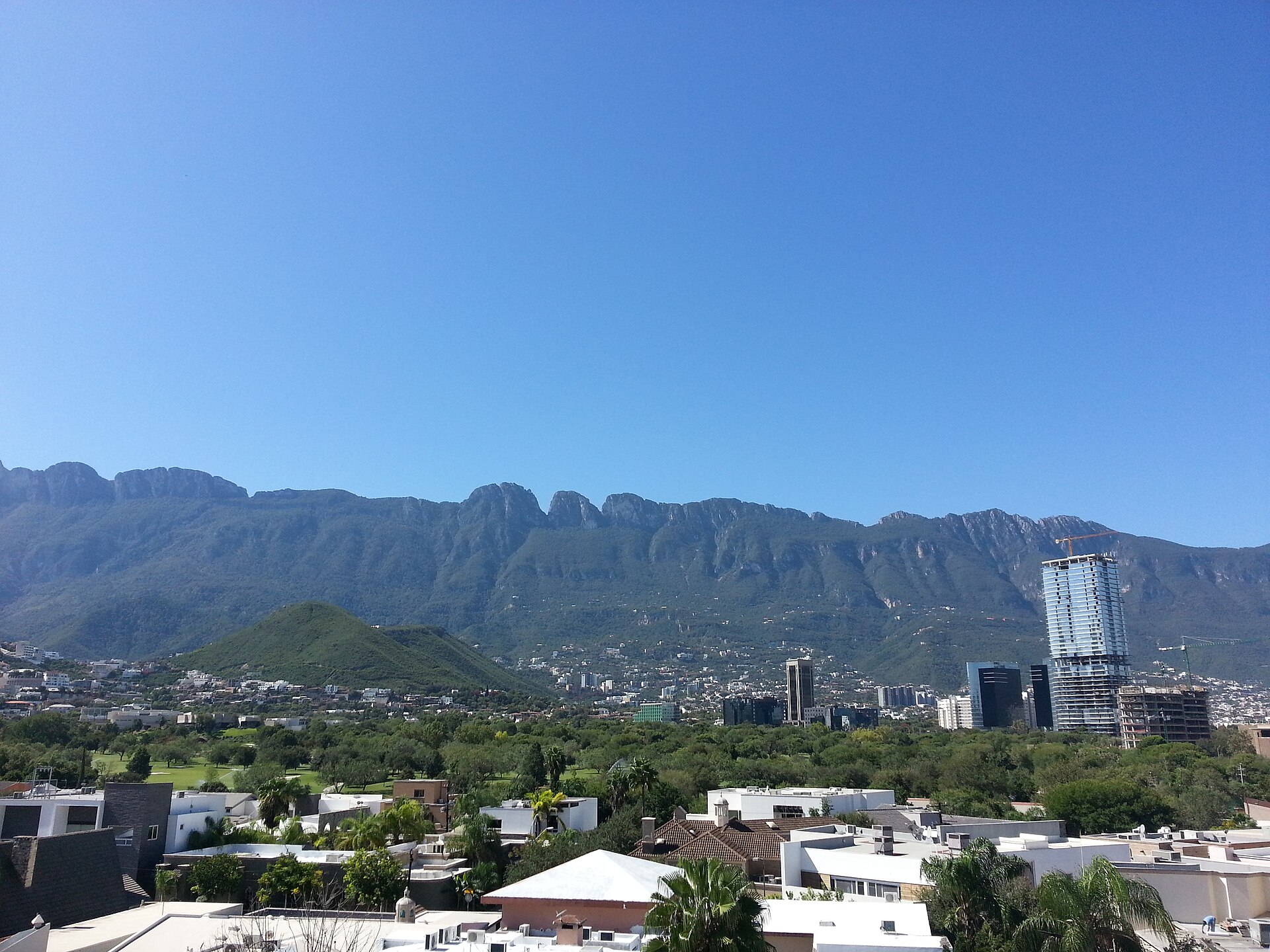
Few large cities are wrapped this tightly by wild terrain. Monterrey rises against the Sierra Madre Oriental, and the ridges that form its skyline are not a distant backdrop but the working edge of an outdoor playground. From a rooftop in San Pedro you can see, in a single sweep, the saddle of Cerro de la Silla to the east, the forested shoulder of Chipinque rising straight off the suburb, and the gash of La Huasteca cut into the range to the west. Almost everything in this guide is reachable from the city center in under an hour.
Most of the high country south and west of the city falls inside Cumbres de Monterrey National Park, decreed by Lázaro Cárdenas in November 1939 and declared a UNESCO biosphere reserve in 2006. It protects well over a thousand square kilometers of canyons, rivers, waterfalls, and peaks across Nuevo León and into Coahuila, and it does real work beyond recreation: this watershed supplies a large share of the metro area's water. The drought years that emptied the Cerro Prieto and La Boca reservoirs were a regional emergency, and they are a reminder that the mountains you hike are also the city's faucet.
The practical takeaway is that you do not travel to the wilderness here. You step into it. That intimacy is the whole appeal, and it is also the trap: because the trailheads are so close, people treat a 1,800-meter summit like a stroll in a park, set off at ten in the morning in June, and end up being carried down. The terrain is serious. Respect it and it is one of the great urban-adjacent ranges in North America.
Chipinque: the forest on the suburb's doorstep
For a first taste of the Sierra Madre, Parque Ecológico Chipinque is the obvious entry point. The reserve sits in San Pedro Garza García, eleven kilometers from downtown, and climbs straight up the mountainside into genuine pine and oak forest. It carries more than sixty kilometers of marked trails, and on a quiet morning you will share them with coatis and white-tailed deer. Black bears live here too, along with the occasional puma — sightings are rare, but this is real fauna, not a petting zoo.
The pricing scheme tells you how regios use the place. Entering on foot costs a token amount; cycling in costs a little more; parking at the visitor center is more again, and driving all the way up the switchbacks to the meseta carries the highest fee — that road is precisely why so many people 'do Chipinque' without breaking a sweat. The honest split is this: the meseta loop, a flat 2.5-kilometer circuit at the top, is the easy postcard, drivable and stroller-friendly. The trails below and above it are not. La M, the lookout at roughly 2,000 meters that gives the mountain its painted white letter, is a steep, sustained climb that humbles people who underestimated it.
Strong hikers continue past La M toward Pinal de Chipinque and the higher antennas above 2,200 meters, where the forest thins and the views open across the whole valley. Check in at the visitor center first — they hold the permits for the longer summit pushes and they know the conditions. The park gates open early, around six, and in the warm months that early start is not a suggestion. It is the difference between a forest walk and a sufferfest.
Cerro de la Silla: harder than it looks
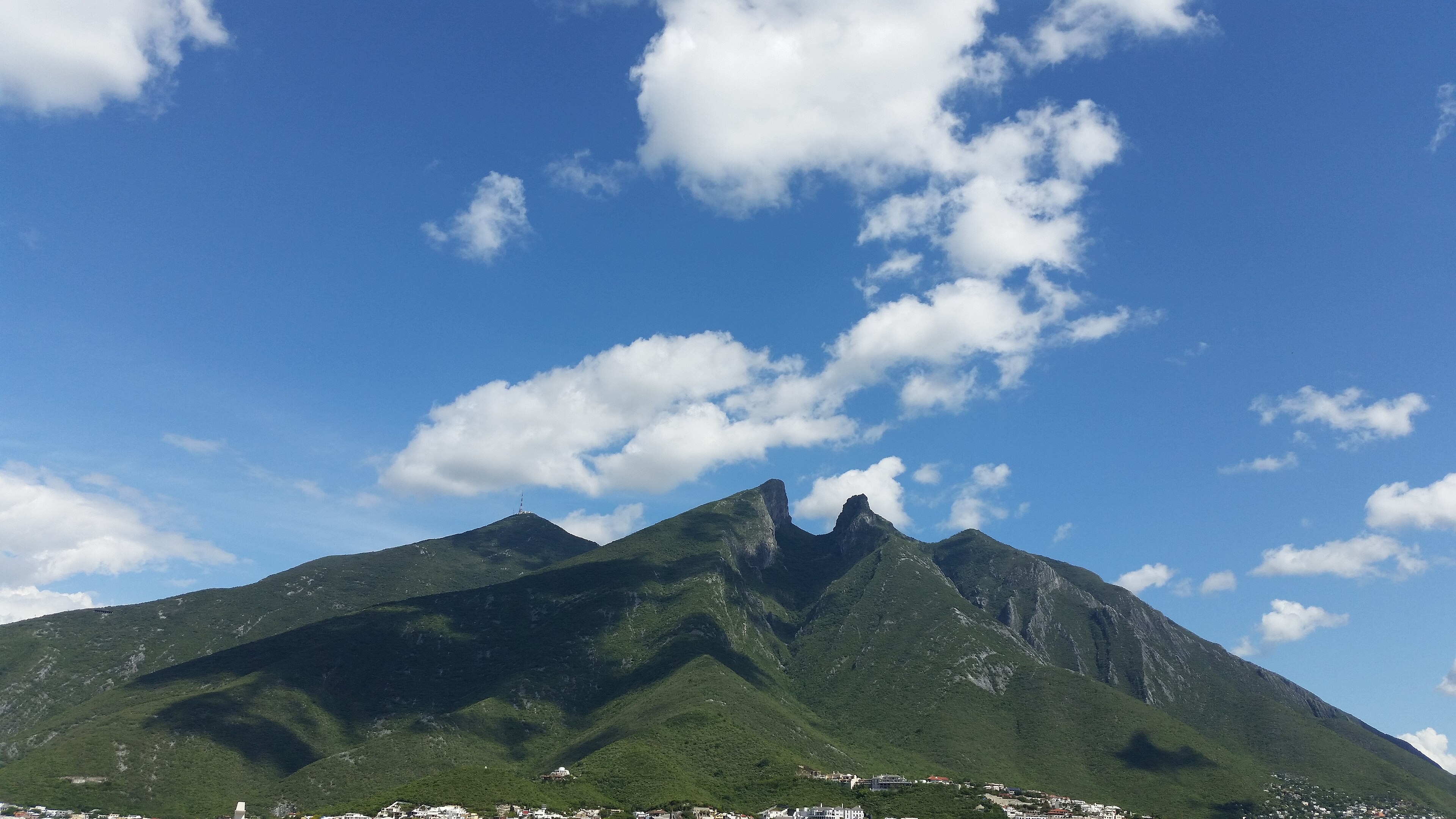
On the eastern side of the city stands Cerro de la Silla, the saddle-shaped mountain stamped on everything from beer labels to the metro logo. It is the city's emblem, and it is a serious hike — the single biggest mismatch between expectation and reality in the whole region. People see it from their living rooms and assume it is a casual outing. It is not.
The standard objective is Pico Norte, the north peak at roughly 1,820 meters. The route most people take starts near the old teleférico on the Guadalupe side and grinds upward for nearly thirteen kilometers round trip, with well over 1,300 meters of climbing. The trail is well signposted, so getting lost is unlikely, but the road section gives way to narrow, rough ground with simple scrambling, and the rock is genuinely slick on the descent. Budget eight to ten hours, carry food, and expect your knees to remember it.
Two honest warnings. First, the difficulty here is not technical, it is environmental: the heat and humidity on those exposed flanks do most of the damage, and the eastern aspect catches brutal morning sun. Second, the higher and southern peaks of the massif involve real exposure and scrambling and are not the same proposition as Pico Norte — leave those to experienced parties. If you want the saddle in your photos and a hard but achievable day in your legs, Pico Norte between November and April is the move.
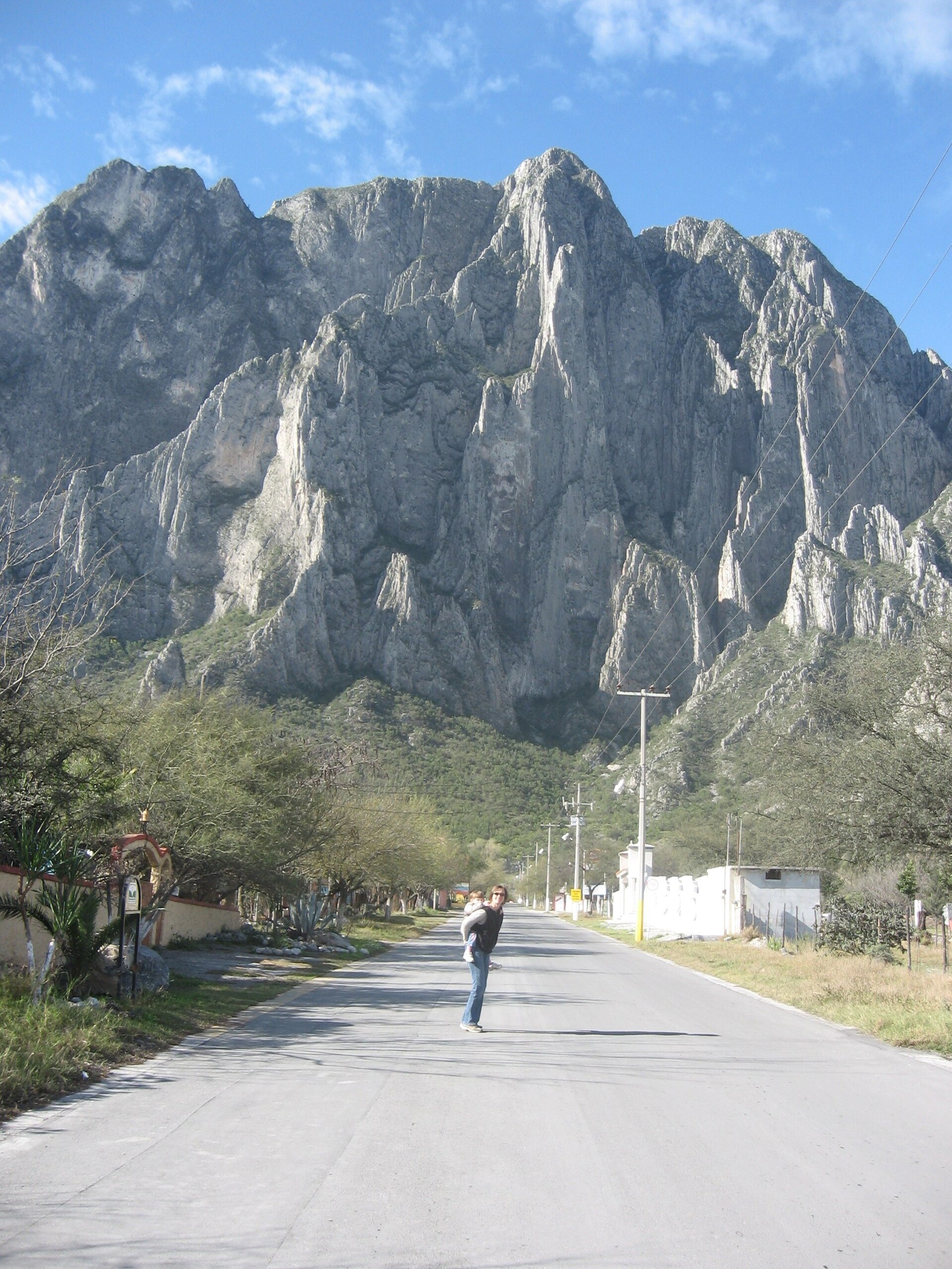
El Potrero Chico: world-class big-wall sport
Monterrey is, quietly, one of the great climbing hubs of North America, and El Potrero Chico is the reason climbers fly in from around the world. The canyon sits just outside Hidalgo, Nuevo León, about an hour north of the city on the edge of the Chihuahuan Desert, and it holds over six hundred and fifty bolted sport routes — more than a hundred and forty of them multipitch — on steep, featured limestone. This is not a crag where you do one pitch and go home. It is built for long, all-day vertical adventures up walls that run hundreds of meters.
The test piece is El Sendero Luminoso, fifteen pitches up the El Toro wall with eleven of them harder than 5.12. On January 15, 2014, Alex Honnold free soloed it in just over three hours, an ascent he called the most technically demanding big wall he had climbed; the route, and Brad Gobright's later death descending in the canyon in 2019, are both part of why the place carries an almost mythic weight among climbers. You do not need to be at that level to belong here — there are plenty of moderate multipitch classics — but you should know the company you are keeping.
Season is everything. Potrero has a real microclimate, and the dry winter window from roughly November through February is prime, with mid-December to mid-March considered the sweet spot and late February often the best of all. Summer is for masochists; the rock bakes. Most visitors camp at one of the canyon-mouth campgrounds, climb in the cool of the morning, and retreat to shade by midday. Bring your own rack and a partner who knows multipitch systems, or hire a local guide — the walls here punish improvisation.
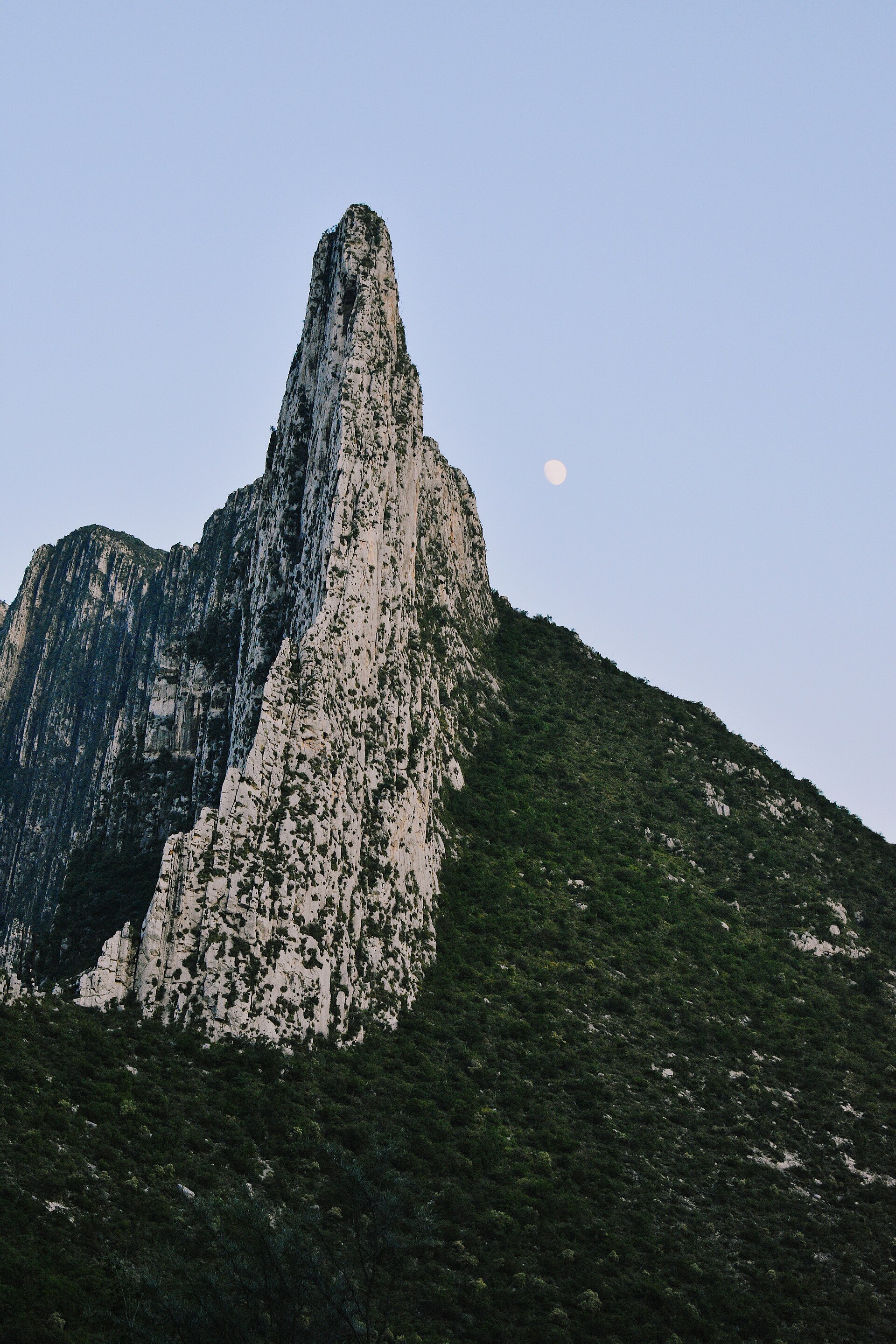
La Huasteca: the canyon you can climb from town
If Potrero is the destination, La Huasteca is the backyard. The canyon opens right off Santa Catarina at the western edge of the metro, a dramatic slot of pale limestone with walls topping 550 meters, carved by the Santa Catarina River. It is part of Cumbres de Monterrey National Park, and most of its climbing areas charge no entrance fee, which is part of why the local scene lives here. There are nearly four hundred bolted routes across grades from beginner 5.4 slabs to elite 5.14 testpieces, spread among dozens of distinct sectors.
Regios talk about La Huasteca's rock in specific terms. The first major crag past the entrance is Cazuelas, named for its texture of thousands of small vase-like pockets, and it concentrates the hardest face climbing in the canyon — more than twenty routes in the 5.12 and 5.13 range. Further down the road, La Extremita is the spot for beginners and intermediates, where outfitters take first-timers up easy bolted lines. The consensus among visiting climbers is that the limestone here runs slicker and more slab-like than Potrero's positive jugs, which makes footwork king.
You do not have to climb to make the trip worthwhile. The drive and walk up the dry riverbed, with the spires leaning in overhead, is one of the most striking short outings near the city, and the paved road through the canyon is a favorite with road cyclists. Go early and on a weekday if you want it to yourself; weekend afternoons fill with families, picnickers, and the inevitable car stereos.
Canyoning at Matacanes and beyond
For something wetter, the canyons of the Sierra de Santiago southeast of the city are the prize. Matacanes is the signature descent — a nine-hour day that combines hiking, swimming through turquoise pools, natural rock slides, cliff jumps, rappels down waterfalls, and two passages that drop underground through caves and a subterranean river. It is rated intermediate and is, by reputation, more fun than fearsome: the rappels are short and straightforward, and the joy is in the jumping and sliding. It is also a committing full-day adventure that should only be done with a competent guide and a real crew.
The harder cousins are Chipitín and Hidrofobia. Chipitín is a proper technical canyon with up to seven rappels, finishing beside a waterfall that drops over eighty meters into an overhanging grotto — it takes multiple guides and a strong team, and it is a genuine step up from Matacanes. Hidrofobia is the natural continuation, usually run on a separate day: less technical but relentless, with something like half a kilometer of swimming through dozens of deep pools and an endless succession of jumps and slides. A life jacket is not optional there.
Crucially, canyoning runs on the opposite calendar from climbing. These canyons need water, so the season generally runs from spring into early fall — exactly the warm, wet months when the high rock is unbearable. That is the elegant logic of the regio outdoor year: when the walls bake, you go underground and underwater. Book through an established operator, because routes get suspended on short notice when river levels spike after heavy rain, and a flash flood in a slot canyon is not a thing you negotiate with.
Cola de Caballo, Grutas de García, and the easy days
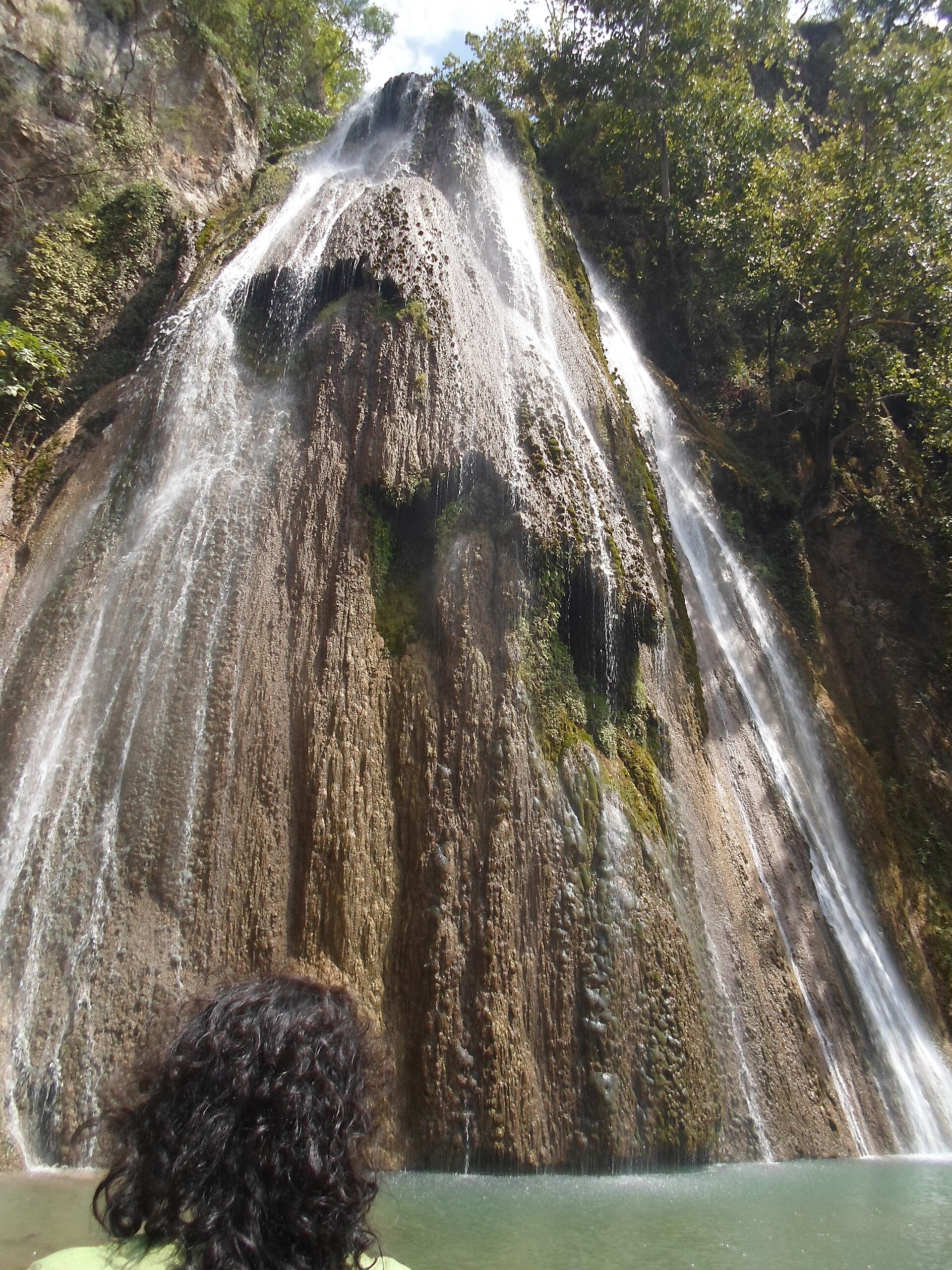
Not every outing has to involve a harness or a 4 a.m. alarm. Cola de Caballo, the 'horsetail' waterfall near the Pueblo Mágico of Villa de Santiago, is the classic family day: a 25-meter cascade fed by the Cumbres high country, about forty-five kilometers southeast of the city, with paved trails, a modest entrance fee, and a cottage industry of horseback rides, zip lines, and suspension bridges around it. It is touristy and it is worth it, especially paired with lunch and a stroll through Santiago's colonnaded plaza.
On the western flank, Grutas de García is the move when the city is melting. The cave system sits inside the national park near Villa de García, a little over an hour out, and you ride a teleférico up to the entrance at around 1,100 meters before walking a well-lit, railed two-kilometer route through sixteen chambers of stalactites, columns, and walls studded with sixty-million-year-old marine fossils. The temperature underground holds steady no matter what the thermometer says outside — a genuine refuge in July. One caveat: the cable car closes for maintenance for stretches each year, so confirm it is running before you drive out.
Both of these are the antidote to the macho framing the region invites. You can spend a Monterrey weekend without rappelling anything, and these are the places to do it — real landscapes, low commitment, and the same Cumbres scenery the hardcore crowd is suffering for higher up.
Running and cycling: the city's quiet endurance scene
Monterrey has a deep, slightly underrated endurance culture, and you see it best at dawn. Road cyclists pour out of San Pedro before sunrise, and the two marquee climbs are local rites of passage: the switchbacked road up into Chipinque, which zigzags toward 1,135 meters and rewards you with the whole valley, and the long, gentle paved run up the floor of La Huasteca. On weekends the city closes stretches for a ciclovía, but the serious riders are on the mountain roads, and the heat dictates that they finish before the sun gets high.
Runners have their own calendar. The Maratón Powerade Monterrey, held each December, is northern Mexico's premier road race, threading past Parque Fundidora and along the riverside promenades with the Cerro de la Silla watching over the whole route. December is no accident — it is the one stretch when running 42 kilometers here does not court heatstroke. Fundidora's loops and the Paseo Santa Lucía draw the everyday running crowd year-round, but the racing season clusters tightly in the cool months.
For trail runners, Chipinque and Cerro de la Silla are the obvious laboratories, and the same warning that governs hikers governs them double: the trail-running community here trains in the dark and is off the mountain by nine in summer. If you are a visitor wanting to fit a run in, copy them. Early, hydrated, and humble.
The summer-heat reality nobody warns you about
Monterrey summers are genuinely dangerous for the unprepared, and this is the single most important thing in this guide. From roughly June through August, daytime highs commonly climb above 35°C (95°F), and the humidity off the Gulf pushes the heat index far higher — direct sun can add the equivalent of another eight degrees Celsius to what your body feels. On an exposed ridge at midday, that is heatstroke territory, and heatstroke is not heat fatigue. It is a medical emergency in which the body stops regulating its own temperature, and it kills people every year doing exactly what you might be planning.
The fix is structural, not heroic. Match the activity to the month: the cool window from about October through April is for the high, exposed rock — Cerro de la Silla, the Chipinque summits, climbing at Potrero and La Huasteca. The warm half of the year is for water and shade — canyoning in Santiago, the Grutas, river pools, and forested Chipinque rather than the bare eastern flanks of the saddle. Working with the calendar instead of against it is the entire secret of the regio outdoor year.
If you do go up on foot in the warm months, treat heat and water as the primary hazard, not an afterthought. Start at first light and aim to be descending before the worst of the sun. Carry far more water than feels reasonable — half a liter to a liter per hour of climbing is a real figure, not a guideline — and add electrolytes, because you will sweat out salt as well as fluid. Wear sun-protective clothing and a hat, watch your group for the early signs of heat illness, and have the discipline to turn around. The mountain will be there in November, when it actually wants your company.